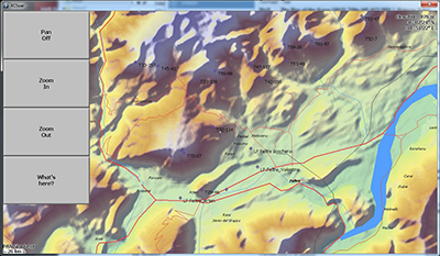
Rob Raymakers hat aus den paraglidingspots-Daten und den wichtigsten Thermiken (Alpen) von http://thermal.kk7.ch eine Datei zur Anzeige in xcsoar erstellt. Basis: Paraglidingspots-Datenbank 11/2015.
Falls Ihr selbst so etwas machen wollt, hier seine Beschreibung, auf Englisch:
Using this tool: http://softop.tomtomusers.com/TomPoiEdr it is very easy to get the paraglidingspots SP/LP and the thermals from http://thermal.kk7.ch to show up in xcsoar.

- Download TomPoiEdr, link see above
- Download the tomtom-files from http://paraglidingspots.com/navigation.aspx
- If you like, also download the thermals from http://thermal.kk7.ch (I only used the top 10000 from the alps) as GPX
- Drag all files into TomPoiEdr. It reads .ov2 and GPX
- Save as .ov2
- Use GPSBabel to convert the .cup. Now you can open it in XCSoar
The .cup can be read in xcsoar. It displays all POIs. The file I created is 2,7MB big.
I haven't chopped it up per country, because i haven't found a way to easily filter POI's based on their gps co-ords into country/areas. The data could be polished a little bit, but for now it works.
